|
previous page |

|
view print |
|
previous page |
|
view print |
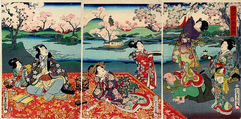
| Utagawa KUNISADA (1786 - 1864) |
Prince Genji (?) being entertained in a park during cherry blossom time |
||
|
Signed: 79-year old Toyokuni hitsu Publisher: Omi-ya Hisagiro Censor's seal: aratame with date seal Date: 1.1864 Size: oban triptych (c. 37. 5 x 25. 3 cms / 14 3/4" x 10") Impression: Very good. Colors: Very good Condition: Very good. - Full paper size with margins. ref. no.: # 581664 - Sold - |